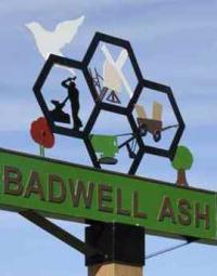


Thank you to everyone who responded to the Residents Survey through February and March. We are pleased with the 41% response rate from households. We will share the results as soon a possible. Our next stage as a Neighbourhood Plan steering group is to start drafting the planning policies for the Plan. Once the Plan is drafted there will be an opportunity to have your say on it before it is submitted for examination.
Everyone in the Parish is getting the chance to make sure their views are taken into account in shaping the Neighbourhood plan. And here’s yours. Please complete the RESIDENTS SURVEY that came through your door, or fill in the survey online HERE.

The Badwell Ash & Long Thurlow Neighbourhood Plan is a planning policy document written by the community to guide future development in the area over the next 20 years.
If successful at referendum, the Neighbourhood Plan will become part of the statutory development plan for the area. It will be used to determine planning applications.
Thank you to all those that attended the Neighbourhood Plan drop-in consultation events in January 2024. Results can be seen HERE.
You can still help us by putting a pin and comment on the online map: www.placecheck.info/app/maps/badwellashlongthurlow

A local Steering Group, involving Parish Councillors and local residents. The group are involved in listening to the community to form the content of the Plan.
Members include: Stephen Russell (chair), Peter Dixon, Katy Haylock, John Morgan and Mark Tomkins. If you would like to get involved, please email badwellashplan@gmail.com.
The area covered by the Neighbourhood Plan is the whole of the parish of Badwell Ash and Long Thurlow.
Below: Parish map of Badwell Ash and Long Thurlow (source: Parish Online, with own annotations). Blue line denotes parish boundary.
